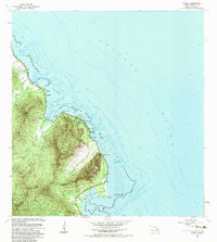
1983 Map of Kahana
USGS Topo · Published 1983About this map
Punaluu and Kaaawa anchor the Windward Coast of Oahu on this early 1980s topographic study, where narrow coastal settlements are hemmed in by the dramatic pali of the Koolau Range. The map details the transition from the Pacific Ocean's reefs and coral heads to the steep interior peaks like Puu Ohulehule and Puu Kanehoalani. A significant portion of the landscape is dedicated to conservation and public recreation, including the expansive Kahana State Park and Kualoa Regional Park. Traditional land use is evident in features such as Molii Pond, an ancient Hawaiian fishpond near Kualoa Point. Along the coastline, landmarks like the Crouching Lion rock formation and the iconic Mokolii Island (Chinamans Hat) sit offshore in Kaneohe Bay, while several beach parks like Swanzy Beach Park line the highway.
Find a feature on this map
52 named features on this map. Tap any name to fly to it.
Don’t see what you’re looking for? This feature index may not catch every label — zoom into the map to look around manually.
Map Details
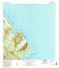
Editions of this 1983 Kahana Map
2 editions found
Other maps of this area

1952 · Mokapu
USGS Topo · 1:24,000

1953 · Hauula
USGS Topo · 1:24,000

1954 · Oahu
USGS Topo · 1:250,000

1954 · Kahuku
USGS Topo · 1:24,000

1954 · Kahana
USGS Topo · 1:24,000

1954 · Kaneohe
USGS Topo · 1:24,000

1954 · Waipahu
USGS Topo · 1:24,000

1959 · Mokapu
USGS Topo · 1:24,000

1959 · Kaneohe
USGS Topo · 1:24,000

1959 · Waipahu
USGS Topo · 1:24,000