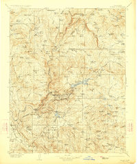
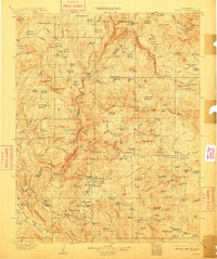
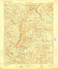
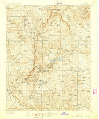
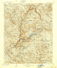
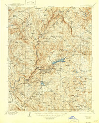
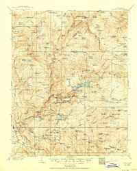
1904 Map of Kaiser
USGS Topo · Published 1923About this map
Chawanakee Rancheria and the early timber settlements of the High Sierra define this landscape during the first years of the twentieth century. The map highlights a burgeoning hydroelectric and timber economy, evidenced by several power houses and an extensive Flume system running through Big Sandy Bluffs. Numerous small-scale industrial sites are scattered across the terrain, including Peckinpah Mill, Sage Mill, and Littlefield Mill, illustrating the reliance on local resources before the modernization of the region's infrastructure.
Find a feature on this map
166 named features on this map. Tap any name to fly to it.
Don’t see what you’re looking for? This feature index may not catch every label — zoom into the map to look around manually.
Map Details
Editions of this 1904 Kaiser Map
8 editions found
Other maps of this area

1897 · Yosemite
USGS Topo · 1:125,000

1900 · Yosemite
USGS Topo · 1:125,000

1901 · Mt. Lyell
USGS Topo · 1:125,000

1903 · Yosemite
USGS Topo · 1:125,000

1903 · Tehipite
USGS Topo · 1:125,000

1904 · Kaiser
USGS Topo · 1:125,000

1905 · Tehipite
USGS Topo · 1:125,000

1909 · Yosemite
USGS Topo · 1:125,000

1912 · Mariposa
USGS Topo · 1:125,000

1912 · Mt. Goddard
USGS Topo · 1:125,000