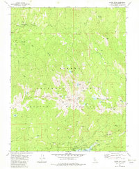
1982 Map of Kaiser Peak
USGS Topo · Published 1982About this map
Kaiser Peak dominates this high-altitude landscape in the Sierra National Forest, serving as the centerpiece for the surrounding Kaiser Wilderness. The 1982 survey details a complex network of glacial lakes and meadows, from Gloria Meadow to the clusters of alpine water bodies like Bill Lake, Jewel Lake, and Upper Twin Lake. Settlement is concentrated at Lakeshore, where a Powerhouse and Surge Chamber indicate the area's hydroelectric infrastructure.
Find a feature on this map
57 named features on this map. Tap any name to fly to it.
Don’t see what you’re looking for? This feature index may not catch every label — zoom into the map to look around manually.
Map Details
Editions of this 1982 Kaiser Peak Map
3 editions found
Other maps of this area

1904 · Kaiser
USGS Topo · 1:125,000

1947 · Mariposa
USGS Topo · 1:250,000

1948 · Mariposa
USGS Topo · 1:250,000

1953 · Huntington Lake
USGS Topo · 1:62,500

1953 · Shaver Lake
USGS Topo · 1:62,500

1953 · Shuteye Peak
USGS Topo · 1:62,500

1953 · Kaiser Peak
USGS Topo · 1:62,500

1957 · Mariposa
USGS Topo · 1:250,000

1963 · Mariposa
USGS Topo · 1:250,000

1980 · Shaver Lake
USGS Topo · 1:100,000