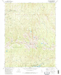
1982 Map of Kaiser Peak
USGS Topo · Published 1983About this map
Kaiser Peak dominates the high-altitude landscape of this central California survey, which documents a region defined by granite ridges and glacial alpine lakes within the Sierra National Forest. The map captures the infrastructure of the early 1980s, from the Kaiser Diggings Forest Service Station to the southern settlement of Lakeshore, where the edge of Huntington Lake is marked by a concentration of recreational sites like the Kinnikinnick Campground and Rancheria.
Find a feature on this map
57 named features on this map. Tap any name to fly to it.
Don’t see what you’re looking for? This feature index may not catch every label — zoom into the map to look around manually.
Map Details
Editions of this 1982 Kaiser Peak Map
3 editions found
Other maps of this area

1904 · Kaiser
USGS Topo · 1:125,000

1947 · Mariposa
USGS Topo · 1:250,000

1948 · Mariposa
USGS Topo · 1:250,000

1953 · Huntington Lake
USGS Topo · 1:62,500

1953 · Shaver Lake
USGS Topo · 1:62,500

1953 · Shuteye Peak
USGS Topo · 1:62,500

1953 · Kaiser Peak
USGS Topo · 1:62,500

1957 · Mariposa
USGS Topo · 1:250,000

1963 · Mariposa
USGS Topo · 1:250,000

1980 · Shaver Lake
USGS Topo · 1:100,000