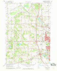
1967 Map of Kalamazoo SW
USGS Topo · Published 1969About this map
Kalamazoo expands westward in the late 1960s, showing the suburban development of Westwood and the academic and medical footprint of the State Hospital grounds near Asylum Lake. The landscape is a mix of rising residential plats and established rural infrastructure, including several outlying settlements like Alamo and Oshtemo. Transportation is anchored by the Penn Central railroad and a grid of lettered thoroughfares such as KL Avenue and G Avenue. Historical local education is well-represented by neighborhood landmarks like the Arcadia Sch, Hurd Sch, and Chime Street Sch, reflecting the community's mid-century growth. For those interested in local recreation and specialized landmarks, the Kalamazoo Speedway and the Newman Landing Field provide distinct points of interest alongside the numerous gravel pits that dot the terrain, illustrating the extraction industry that shaped the local topography.
Find a feature on this map
77 named features on this map. Tap any name to fly to it.
Don’t see what you’re looking for? This feature index may not catch every label — zoom into the map to look around manually.
Map Details
Editions of this 1967 Kalamazoo SW Map
4 editions found
Other maps of this area

1916 · Kalamazoo
USGS Topo · 1:62,500

1918 · Kalamazoo
USGS Topo · 1:62,500

1922 · Schoolcraft
USGS Topo · 1:62,500

1943 · Kalamazoo
USGS Topo · 1:62,500

1943 · Schoolcraft
USGS Topo · 1:62,500

1944 · Marcellus
USGS Topo · 1:62,500

1946 · Marcellus
USGS Topo · 1:62,500

1946 · Gobles
USGS Topo · 1:62,500

1948 · Gobles
USGS Topo · 1:62,500

1949 · Gobles
USGS Topo · 1:62,500