
1957 Map of Kalispell
USGS Topo · Published 1967About this map
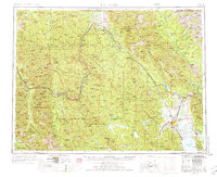
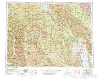
Glacier National Park dominates the northeast corner of this Northwest Montana survey, showcasing the high-altitude terrain of the Apar Mountains and peaks like Mt Custer and Mt Chapman along the international border. In the lowlands, the Great Northern railroad tracks define the settlement corridor through Whitefish, Columbia Falls, and Kalispell. This mid-century view captures the region just after the massive engineering feat of the Hungry Horse Reservoir was completed on the South Fork Flathead River.
Find a feature on this map
227 named features on this map. Tap any name to fly to it.
Don’t see what you’re looking for? This feature index may not catch every label — zoom into the map to look around manually.
Map Details
Editions of this 1957 Kalispell Map
3 editions found
Other maps of this area

1904 · Chief Mountain
USGS Topo · 1:125,000

1906 · Kintla Lakes
USGS Topo · 1:125,000

1909 · Cataldo
USGS Topo · 1:125,000

1911 · Cataldo
USGS Topo · 1:125,000

1911 · Priest Lake
USGS Topo · 1:250,000

1913 · Priest Lake
USGS Topo · 1:250,000

1913 · Stryker
USGS Topo · 1:125,000

1914 · Nyack
USGS Topo · 1:125,000

1916 · Stryker
USGS Topo · 1:125,000

1920 · Flathead Lake
USGS Topo · 1:125,000