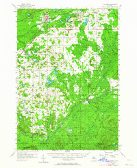
1956 Map of Kalkaska
USGS Topo · Published 1964About this map
The Kalkaska village center and its surrounding timberlands are defined by the intersection of the Pennsylvania Railroad and the waters of the Boardman River. This 1950s landscape shows a transition from the village hub to the dense, wooded tracts of the Au Sable State Forest, where a network of rural schoolhouses like Maple Grove Sch and Tyler Sch served the outlying townships of Excelsior and Orange. Along the southern border, the Manistee River winds through more remote territory near Smithville and Taffeltown. The map preserves the locations of numerous country churches, including Evergreen Ch and East Boardman Ch, providing a clear record of the social geography that tied these small agricultural and lumbering communities together before modern consolidation altered the rural school and church systems.
Find a feature on this map
92 named features on this map. Tap any name to fly to it.
Don’t see what you’re looking for? This feature index may not catch every label — zoom into the map to look around manually.
Map Details
Editions of this 1956 Kalkaska Map
4 editions found
Other maps of this area

1949 · Black Creek
USGS Topo · 1:24,000

1949 · Fletcher
USGS Topo · 1:62,500

1950 · Fletcher
USGS Topo · 1:24,000

1954 · Traverse City
USGS Topo · 1:250,000

1956 · Alba
USGS Topo · 1:62,500

1956 · Mancelona
USGS Topo · 1:62,500

1956 · Kalkaska
USGS Topo · 1:62,500

1956 · Fife Lake
USGS Topo · 1:62,500

1956 · Houghton Lake
USGS Topo · 1:62,500

1956 · Cadillac North
USGS Topo · 1:62,500