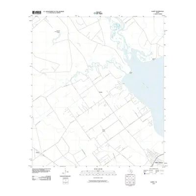
2010 Map of Kamey
USGS Topo · Published 2010About this map
Lavaca Bay defines the eastern shoreline of this coastal Texas region, where the waters of Garcitas Creek and Placedo Creek empty into Garcitas Cove. The landscape is a complex network of coastal prairie and tidal inlets, transitioning into more developed areas toward the south. The northern reach of Port Lavaca is visible along the lower edge, while the inland settlements of Sixmile and Kamey are connected by a grid of rural routes and farm-to-market roads.
Find a feature on this map
38 named features on this map. Tap any name to fly to it.
Don’t see what you’re looking for? This feature index may not catch every label — zoom into the map to look around manually.
Map Details
Editions of this 2010 Kamey Map
This is the sole edition of this map. No revisions or reprints were ever made.
Other maps of this area

1952 · Port Lavaca East
USGS Topo · 1:24,000

1952 · Point Comfort
USGS Topo · 1:24,000

1952 · Kamey
USGS Topo · 1:24,000

1952 · Port Lavaca West
USGS Topo · 1:24,000

1952 · La Salle
USGS Topo · 1:24,000

1952 · Marcado Creek
USGS Topo · 1:24,000

1952 · Placedo
USGS Topo · 1:24,000

1952 · Lolita
USGS Topo · 1:24,000

1952 · Green Lake
USGS Topo · 1:24,000

1953 · Beeville
USGS Topo · 1:250,000