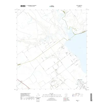
2019 Map of Kamey
USGS Topo · Published 2019About this map
The coastal marshlands and agricultural plains of the Texas Gulf Coast meet at Lavaca Bay, where complex drainage systems like Garcitas Creek and Placedo Creek empty into Garcitas Cove. This coastal interface is marked by prominent landmarks such as Keeran Point and Bennett Point, which define the northern reaches of the bay. Inland, the landscape transition is seen in the grid-like road network supporting the settlement of Kamey and the northwestern outskirts of Port Lavaca. The area's infrastructure is anchored by aviation and local history, featuring the Calhoun County Airport, Sterling Airport, and the Six Mile Cem. Water remains the dominant geographic force, with numerous smaller tributaries like Sixmile Cr and Little Chocolate Bayou meandering through the low-lying terrain toward the sea.
Find a feature on this map
65 named features on this map. Tap any name to fly to it.
Don’t see what you’re looking for? This feature index may not catch every label — zoom into the map to look around manually.
Map Details
Editions of this 2019 Kamey Map
This is the sole edition of this map. No revisions or reprints were ever made.
Other maps of this area

1952 · Port Lavaca East
USGS Topo · 1:24,000

1952 · Point Comfort
USGS Topo · 1:24,000

1952 · Kamey
USGS Topo · 1:24,000

1952 · Port Lavaca West
USGS Topo · 1:24,000

1952 · La Salle
USGS Topo · 1:24,000

1952 · Marcado Creek
USGS Topo · 1:24,000

1952 · Placedo
USGS Topo · 1:24,000

1952 · Lolita
USGS Topo · 1:24,000

1952 · Green Lake
USGS Topo · 1:24,000

1953 · Beeville
USGS Topo · 1:250,000