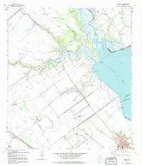
1995 Map of Kamey
USGS Topo · Published 1995About this map
Lavaca Bay dominates the eastern horizon of this coastal Texas landscape, where the tides meet a network of bayous and creeks. The coastal economy of the mid-1990s is visible in the extensive Oil and Gas Field and the infrastructure of Port Lavaca in the southeast corner. Inland, the terrain is defined by a system of drainage and protection, including a prominent Road on Levee and numerous borrow pits.
Find a feature on this map
36 named features on this map. Tap any name to fly to it.
Don’t see what you’re looking for? This feature index may not catch every label — zoom into the map to look around manually.
Map Details
Editions of this 1995 Kamey Map
This is the sole edition of this map. No revisions or reprints were ever made.
Other maps of this area

1952 · Port Lavaca East
USGS Topo · 1:24,000

1952 · Point Comfort
USGS Topo · 1:24,000

1952 · Kamey
USGS Topo · 1:24,000

1952 · Port Lavaca West
USGS Topo · 1:24,000

1952 · La Salle
USGS Topo · 1:24,000

1952 · Marcado Creek
USGS Topo · 1:24,000

1952 · Placedo
USGS Topo · 1:24,000

1952 · Lolita
USGS Topo · 1:24,000

1952 · Green Lake
USGS Topo · 1:24,000

1953 · Beeville
USGS Topo · 1:250,000