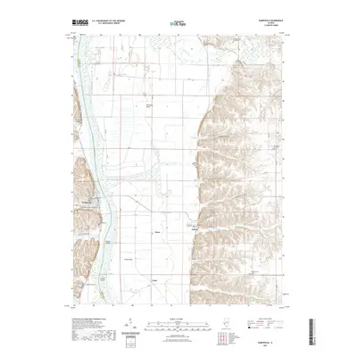
2021 Map of Kampsville
USGS Topo · Published 2021About this map
The Illinois River serves as the primary geographic corridor of this region, dividing the landscape between Calhoun and Greene counties. The village of Kampsville sits on the western bank, anchored by the Kampsville PO, while the settlement of Eldred is situated to the east near the base of the bluff line. The terrain transitions from the river's floodplain, marked by features like Willow Island and Crater Island, into a series of deep drainages including Robley Hollow, Eldred Hollow, and Bushnell Hollow.
Find a feature on this map
40 named features on this map. Tap any name to fly to it.
Don’t see what you’re looking for? This feature index may not catch every label — zoom into the map to look around manually.
Map Details
Editions of this 2021 Kampsville Map
This is the sole edition of this map. No revisions or reprints were ever made.
Other maps of this area

1924 · Roodhouse
USGS Topo · 1:62,500

1926 · Roodhouse
USGS Topo · 1:62,500

1930 · Pearl
USGS Topo · 1:62,500

1930 · Hardin
USGS Topo · 1:62,500

1930 · Jerseyville
USGS Topo · 1:62,500

1933 · Jerseyville
USGS Topo · 1:62,500

1934 · Hardin
USGS Topo · 1:62,500

1938 · Hardin
USGS Topo · 1:62,500

1948 · Quincy
USGS Topo · 1:250,000

1950 · Pearl
USGS Topo · 1:62,500