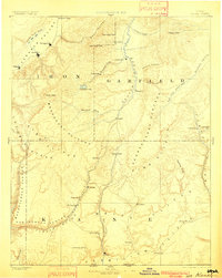
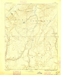
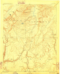
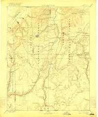
1886 Map of Kanab
USGS Topo · Published 1901About this map
Kanab and the high southern plateaus of Utah are documented here in this late nineteenth-century reconnaissance, conducted under the direction of J.W. Powell. The map reveals a frontier landscape defined by dramatic geological transitions, from the White Cliffs and Vermilion Cliffs in the south to the massive Paunsaugunt Plateau and Markagunt Plateau further north. Early Mormon settlements such as Orderville, Glendale, and Mt Carmel are shown clustered along the upper reaches of the Virgin River and Kanab Creek, illustrating the era's reliance on canyon bottoms for irrigation and travel.
Find a feature on this map
53 named features on this map. Tap any name to fly to it.
Don’t see what you’re looking for? This feature index may not catch every label — zoom into the map to look around manually.
Map Details
Editions of this 1886 Kanab Map
5 editions found
Other maps of this area

1885 · St. George
USGS Topo · 1:250,000

1885 · Beaver
USGS Topo · 1:250,000

1885 · Fish Lake
USGS Topo · 1:250,000

1886 · Kanab
USGS Topo · 1:250,000

1886 · Escalante
USGS Topo · 1:250,000

1886 · Mt. Trumbull
USGS Topo · 1:250,000

1886 · Echo Cliffs
USGS Topo · 1:250,000

1886 · Kaibab
USGS Topo · 1:250,000

1891 · St. George
USGS Topo · 1:250,000

1891 · Echo Cliffs
USGS Topo · 1:250,000