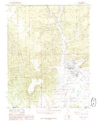
1985 Map of Kanab
USGS Topo · Published 1985About this map
Kanab serves as the focal point of this 1985 provisional study, situated where the high desert plateau meets the towering Vermilion Cliffs. The street grid of the town is clearly defined, showing residential and commercial development south of the mouth of Kanab Creek. The map records essential mid-century infrastructure including the Kanab Municipal Airport and a Sewage Disposal Plant, reflecting the town's role as a regional hub.
Find a feature on this map
29 named features on this map. Tap any name to fly to it.
Don’t see what you’re looking for? This feature index may not catch every label — zoom into the map to look around manually.
Map Details
Editions of this 1985 Kanab Map
2 editions found
Other maps of this area

1886 · Kanab
USGS Topo · 1:250,000

1886 · Kaibab
USGS Topo · 1:250,000

1953 · Cedar City
USGS Topo · 1:250,000

1953 · Grand Canyon
USGS Topo · 1:250,000

1954 · Kanab SW
USGS Topo · 1:24,000

1954 · Fredonia NW
USGS Topo · 1:24,000

1954 · Kanab SE
USGS Topo · 1:24,000

1954 · Shinarump NW
USGS Topo · 1:24,000

1954 · Johnson SW
USGS Topo · 1:24,000

1954 · Fredonia NE
USGS Topo · 1:24,000