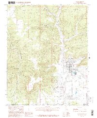
1985 Map of Kanab
USGS Topo · Published 1985About this map
The town of Kanab serves as the central hub of this 1985 survey, positioned where the high desert floor meets the dramatic rise of the Vermilion Cliffs. This landscape is defined by its deep drainages and named formations, such as The Elephant and Savage Point, which underscore the geological character of the Utah-Arizona border. The presence of the Movie Set (Fort) west of the main settlement reflects the area's long-standing connection to the film industry, a notable cultural detail alongside more functional landmarks like the Kanab Municipal Airport and the local Cem. The northern reaches of the Kaibab Indian Reservation extend into the lower portion of the sheet, while water systems such as Kanab Creek and Three Lakes Canyon highlight the drainage patterns through canyons like Hog Canyon and Hell Dive Canyon.
Find a feature on this map
31 named features on this map. Tap any name to fly to it.
Don’t see what you’re looking for? This feature index may not catch every label — zoom into the map to look around manually.
Map Details
Editions of this 1985 Kanab Map
2 editions found
Other maps of this area

1886 · Kanab
USGS Topo · 1:250,000

1886 · Kaibab
USGS Topo · 1:250,000

1953 · Cedar City
USGS Topo · 1:250,000

1953 · Grand Canyon
USGS Topo · 1:250,000

1954 · Kanab SW
USGS Topo · 1:24,000

1954 · Fredonia NW
USGS Topo · 1:24,000

1954 · Kanab SE
USGS Topo · 1:24,000

1954 · Shinarump NW
USGS Topo · 1:24,000

1954 · Johnson SW
USGS Topo · 1:24,000

1954 · Fredonia NE
USGS Topo · 1:24,000