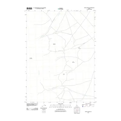
2010 Map of Kane Canyon
USGS Topo · Published 2010About this map
Red Rock Mountain and the eastern slopes of the Jim Sage Mountains dominate this high-desert basin in southern Idaho. The landscape is defined by its seasonal water sources and the infrastructure of the ranching industry, evidenced by the winding path of Ward Sheep Ranch Rd and the network of trails connecting vital water points like Red Rock Spring and Kane Spring.
Find a feature on this map
11 named features on this map. Tap any name to fly to it.
Don’t see what you’re looking for? This feature index may not catch every label — zoom into the map to look around manually.
Map Details
Editions of this 2010 Kane Canyon Map
This is the sole edition of this map. No revisions or reprints were ever made.
Other maps of this area

1954 · Pocatello
USGS Topo · 1:250,000

1958 · Pocatello
USGS Topo · 1:250,000

1968 · Malta
USGS Topo · 1:24,000

1968 · Jim Sage Canyon
USGS Topo · 1:24,000

1968 · Elba
USGS Topo · 1:24,000

1968 · Kane Canyon
USGS Topo · 1:24,000

1968 · Nibbs Creek
USGS Topo · 1:24,000

1968 · Naf
USGS Topo · 1:24,000

1968 · Chokecherry Canyon
USGS Topo · 1:24,000
1968 · Connor Ridge
USGS Topo · 1:24,000