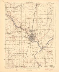
1924 Map of Kankakee
USGS Topo · Published 1924About this map
Kankakee River and Iroquois River converge in a landscape defined by 1920s rail infrastructure and rural educational centers. The city of Kankakee serves as a dense core for the surrounding communities of Bradley and Bourbonnais, with the sprawling grounds of the East Illinois Hospital situated on the river's southern bank. This survey documents a critical era of transit, showing the path of the Illinois Central Electric Interurban and the Egyptian Trail cutting north-south through the townships.
Find a feature on this map
91 named features on this map. Tap any name to fly to it.
Don’t see what you’re looking for? This feature index may not catch every label — zoom into the map to look around manually.
Map Details
Editions of this 1924 Kankakee Map
2 editions found
Other maps of this area

1892 · Wilmington
USGS Topo · 1:62,500

1918 · Wilmington
USGS Topo · 1:62,500

1922 · Momence
USGS Topo · 1:62,500

1922 · Kankakee
USGS Topo · 1:62,500

1923 · Herscher
USGS Topo · 1:62,500

1924 · Momence
USGS Topo · 1:62,500

1924 · Kankakee
USGS Topo · 1:62,500

1925 · Herscher
USGS Topo · 1:62,500

1935 · Watseka
USGS Topo · 1:48,000

1939 · Watseka
USGS Topo · 1:62,500