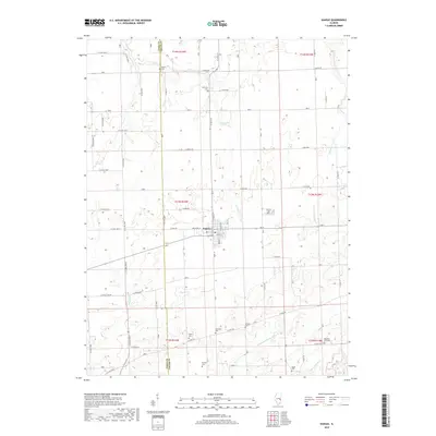
2018 Map of Kansas
USGS Topo · Published 2018About this map
The village of Kansas serves as the central hub of this East Central Illinois survey, situated along the county line where Coles Co and Edgar Co meet. The grid of the town is clearly defined by streets such as Jefferson St and N Franklin St, with a Po located near the town center. The surrounding landscape is a patchwork of agricultural sections drained by a complex network of waterways, including Polecat Cr, Donica Cr, and the N Fork Embarras River.
Find a feature on this map
70 named features on this map. Tap any name to fly to it.
Don’t see what you’re looking for? This feature index may not catch every label — zoom into the map to look around manually.
Map Details
Editions of this 2018 Kansas Map
This is the sole edition of this map. No revisions or reprints were ever made.
Other maps of this area

1933 · Toledo
USGS Topo · 1:62,500

1936 · Oakland
USGS Topo · 1:48,000

1936 · Casey
USGS Topo · 1:48,000

1938 · Toledo
USGS Topo · 1:62,500

1942 · Oakland
USGS Topo · 1:62,500

1942 · Casey
USGS Topo · 1:62,500

1943 · Casey
USGS Topo · 1:62,500

1946 · Kansas
USGS Topo · 1:62,500

1949 · Kansas
USGS Topo · 1:62,500

1953 · Indianapolis
USGS Topo · 1:250,000