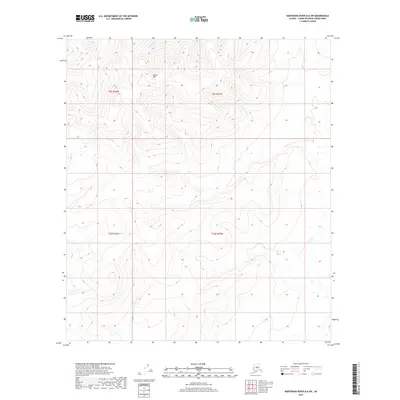
2017 Map of Kantishna River A-6 SW
USGS Topo · Published 2017About this map
Sischu Mtn dominates the central terrain of this remote Yukon-Koyukuk interior region, serving as a primary drainage divide for the surrounding wilderness. To the north, the headwaters of the Titna River carve through the high ground, while the southern slopes feed the narrow drainages of Sischu Cr and Lynx Cr. The map reveals a landscape defined by sharp elevation shifts and a lack of established infrastructure, typical of the Alaskan interior before modern development. These watercourses represent the primary navigational landmarks in a region where seasonal flow and topographic relief dictate movement across the territory.
Find a feature on this map
8 named features on this map. Tap any name to fly to it.
Don’t see what you’re looking for? This feature index may not catch every label — zoom into the map to look around manually.
Map Details
Editions of this 2017 Kantishna River A-6 SW Map
This is the sole edition of this map. No revisions or reprints were ever made.
Other maps of this area

1948 · Kantishna River
USGS Topo · 1:250,000

1950 · Medfra
USGS Topo · 1:250,000

1951 · Kantishna River
USGS Topo · 1:250,000

1951 · Ruby
USGS Topo · 1:250,000

1952 · Mount McKinley
USGS Topo · 1:250,000

1952 · Ruby A-1
USGS Topo · 1:63,360

1952 · Kantishna River
USGS Topo · 1:250,000

1952 · Kantishna River A-6
USGS Topo · 1:63,360

1952 · Ruby
USGS Topo · 1:250,000
1953 · Kantishna River A-6
USGS Topo · 1:63,360