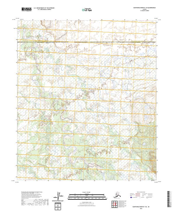
2024 Map of Kantishna River B-1 SE
USGS Topo · Published 2024About this map
The Toklat River meanders through a sprawling wetland complex in this interior Alaskan landscape, marking the transition from the low-lying plains toward the Toklat Hills in the southeast. The survey highlights a dynamic river system where the water divides into multiple braids and oxbow loops, a characteristic pattern for glacial-fed rivers in the region. This 2024 data captures the political boundary between the Yukon-Koyukuk Census Area and the Denali Borough, which cuts across the northern section of the map. Aside from these administrative lines and the significant drainage of the river, the area remains an undeveloped expanse of wilderness defined by its complex hydrography and varying elevations.
Find a feature on this map
12 named features on this map. Tap any name to fly to it.
Don’t see what you’re looking for? This feature index may not catch every label — zoom into the map to look around manually.
Map Details
Editions of this 2024 Kantishna River B-1 SE Map
This is the sole edition of this map. No revisions or reprints were ever made.
Other maps of this area

1948 · Kantishna River
USGS Topo · 1:250,000

1950 · Fairbanks
USGS Topo · 1:250,000

1951 · Kantishna River
USGS Topo · 1:250,000

1951 · Fairbanks
USGS Topo · 1:250,000

1952 · Fairbanks A-6
USGS Topo · 1:63,360

1952 · Kantishna River A-1
USGS Topo · 1:63,360

1952 · Kantishna River
USGS Topo · 1:250,000

1952 · Kantishna River B-1
USGS Topo · 1:63,360

1952 · Fairbanks
USGS Topo · 1:250,000
1953 · Fairbanks B-6
USGS Topo · 1:63,360