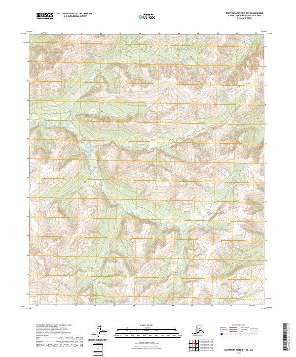
2024 Map of Kantishna River B-4 SE
USGS Topo · Published 2024About this map
The North Fork Kuskokwim River winds through this interior Alaskan wilderness, cutting across the western portion of the quadrangle. The landscape is defined by its complex hydrology and dramatic elevation changes, characterized by the winding path of the Zitziana River in the northeast. This 2024 USGS survey documents the uninhabited terrain within the Yukon-Koyukuk Census Area, illustrating the natural drainage patterns across several townships including t6s r21w, t7s r21w, and t8s r21w. The topographical detail captures the fine contouring of the region’s ridges and valleys, providing an essential record of this remote river system before future environmental shifts alter its course.
Find a feature on this map
8 named features on this map. Tap any name to fly to it.
Don’t see what you’re looking for? This feature index may not catch every label — zoom into the map to look around manually.
Map Details
Editions of this 2024 Kantishna River B-4 SE Map
This is the sole edition of this map. No revisions or reprints were ever made.
Other maps of this area

1948 · Kantishna River
USGS Topo · 1:250,000

1951 · Kantishna River
USGS Topo · 1:250,000

1952 · Kantishna River A-3
USGS Topo · 1:63,360

1952 · Kantishna River
USGS Topo · 1:250,000

1953 · Kantishna River B-4
USGS Topo · 1:63,360

1953 · Kantishna River A-4
USGS Topo · 1:63,360

1953 · Kantishna River B-3
USGS Topo · 1:63,360

1953 · Kantishna River A-3
USGS Topo · 1:63,360

1964 · Kantishna River
USGS Topo · 1:250,000
2017 · Kantishna River B-4 SE
USGS Topo · 1:25,000