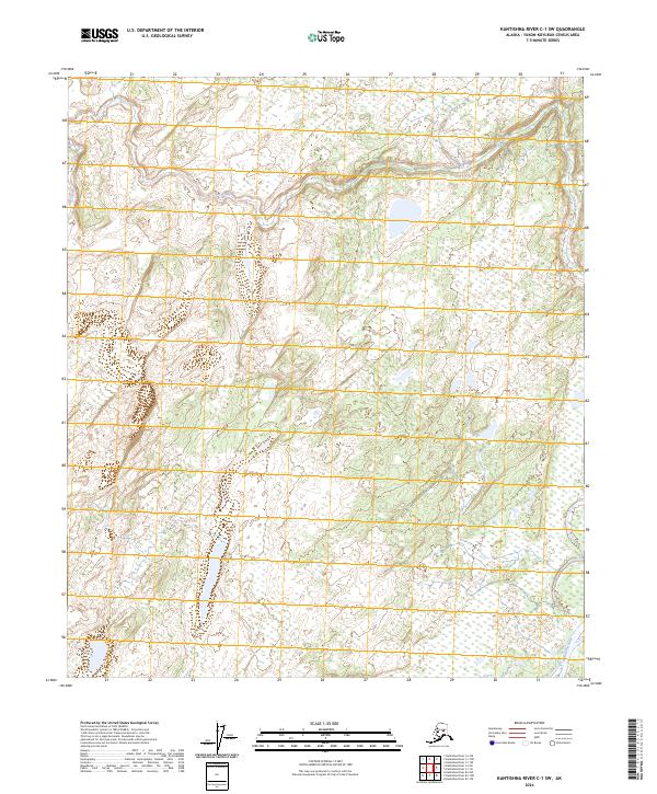
2024 Map of Kantishna River C-1 SW
USGS Topo · Published 2024About this map
Kantishna River winds through the southeastern corner of this Alaskan interior landscape, a region defined by extensive wetlands and a complex network of seasonal drainages. The map reveals the shifting nature of the subarctic environment, where Dry Creek meanders across the northern sections, cutting through varied township boundaries like t3s r15w and t4s r14w. This area is largely characterized by muskeg and low-lying brush typical of the Yukon-Koyukuk Census Area, with the terrain providing few permanent landmarks other than its primary waterways. The grid of the Public Land Survey System imposes a human order over this largely untouched wilderness, marking out blocks of land across the expansive, water-saturated flats.
Find a feature on this map
8 named features on this map. Tap any name to fly to it.
Don’t see what you’re looking for? This feature index may not catch every label — zoom into the map to look around manually.
Map Details
Editions of this 2024 Kantishna River C-1 SW Map
This is the sole edition of this map. No revisions or reprints were ever made.
Other maps of this area

1948 · Kantishna River
USGS Topo · 1:250,000

1951 · Kantishna River
USGS Topo · 1:250,000

1952 · Kantishna River C-1
USGS Topo · 1:63,360

1952 · Kantishna River
USGS Topo · 1:250,000

1952 · Kantishna River B-1
USGS Topo · 1:63,360

1953 · Kantishna River B-2
USGS Topo · 1:63,360
1953 · Kantishna River C-2
USGS Topo · 1:63,360
1954 · Kantishna River C-2
USGS Topo · 1:63,360

1964 · Kantishna River
USGS Topo · 1:250,000
2017 · Kantishna River C-1 SE
USGS Topo · 1:25,000