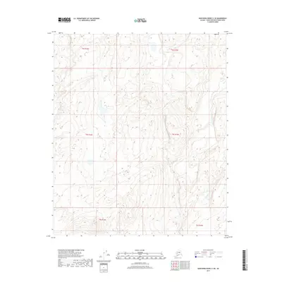
2017 Map of Kantishna River C-2 SE
USGS Topo · Published 2017About this map
The interior wilderness of the Yukon-Minyukuk Census Area is defined here by the winding course of Dry Cr, which threads through a landscape of significant elevation changes and complex drainage patterns. Located within the Kantishna River C-2 SE quadrangle, this area is characterized by the systematic grid of the Public Land Survey System, including townships such as t4s r16w and t4s r15w. The map reveals a subarctic terrain largely devoid of permanent settlements or roads, offering a detailed view of the natural hydrology and contour intervals that shape this portion of the Alaska interior. The absence of human infrastructure highlights the territory's status as a remote frontier, where geographic features like the drainage of Dry Cr remain the primary landmarks for navigation and land management.
Find a feature on this map
7 named features on this map. Tap any name to fly to it.
Don’t see what you’re looking for? This feature index may not catch every label — zoom into the map to look around manually.
Map Details
Editions of this 2017 Kantishna River C-2 SE Map
This is the sole edition of this map. No revisions or reprints were ever made.
Other maps of this area

1948 · Kantishna River
USGS Topo · 1:250,000

1951 · Kantishna River
USGS Topo · 1:250,000

1952 · Kantishna River C-1
USGS Topo · 1:63,360

1952 · Kantishna River
USGS Topo · 1:250,000

1952 · Kantishna River B-1
USGS Topo · 1:63,360

1953 · Kantishna River B-2
USGS Topo · 1:63,360
1953 · Kantishna River C-2
USGS Topo · 1:63,360
1954 · Kantishna River C-2
USGS Topo · 1:63,360

1964 · Kantishna River
USGS Topo · 1:250,000
2017 · Kantishna River B-2 NW
USGS Topo · 1:25,000