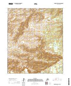
2017 Map of Kantishna River D-4 NW
USGS Topo · Published 2017About this map
The Chitanana River flows through the southeastern corner of this Interior Alaska landscape, where low-lying wetlands transition into more defined topographical ridges. This 2017 survey illustrates a largely uninhabited wilderness where water drainage patterns dictate the terrain. In the northwest, the headwaters of Birch Cr meander through a series of small, unnamed ponds and marshy depressions characteristic of the Yukon-Koyukuk region. The map serves as a detailed study of the natural hydrological boundaries and the vast, undeveloped sections of the t1n r21w and t2n r22w townships. For those tracking the geography of the Alaska interior, the intricate contour lines reveal the subtle elevations that rise between the ancient river channels and the surrounding basin.
Find a feature on this map
6 named features on this map. Tap any name to fly to it.
Don’t see what you’re looking for? This feature index may not catch every label — zoom into the map to look around manually.
Map Details
Editions of this 2017 Kantishna River D-4 NW Map
This is the sole edition of this map. No revisions or reprints were ever made.
Other maps of this area

1948 · Kantishna River
USGS Topo · 1:250,000

1951 · Kantishna River
USGS Topo · 1:250,000

1951 · Tanana
USGS Topo · 1:250,000

1952 · Tanana A-4
USGS Topo · 1:63,360

1952 · Kantishna River D-5
USGS Topo · 1:63,360

1952 · Kantishna River
USGS Topo · 1:250,000

1952 · Tanana A-5
USGS Topo · 1:63,360
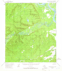
1953 · Kantishna River D-5
USGS Topo · 1:63,360

1953 · Tanana A-5
USGS Topo · 1:63,360
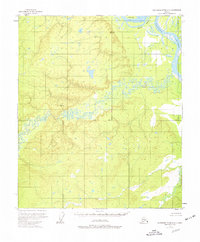
1953 · Kantishna River D-4
USGS Topo · 1:63,360