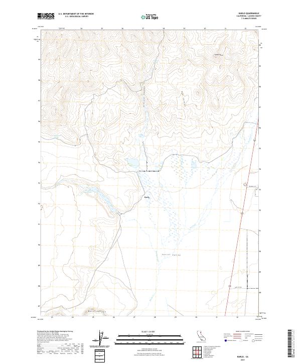
2021 Map of Karlo
USGS Topo · Published 2021About this map
Karlo sits at the heart of this high-desert landscape in Lassen County, where the hydrological patterns of Secret Valley define the terrain. The presence of Biscar Reservoir and the drainage of Secret Cr and Snowstorm Cr reveal a territory where water management is central to the land's utility. The topography is marked by significant erosion features such as Vincent Canyon and Nye Canyon to the north, while Balls Canyon anchors the southern boundary. This 2021 survey reflects the enduring spatial organization of the region, showing the intersection of local routes like Trumball Rd and Deep Cut Rd amidst the section lines of the Public Land Survey System. Strategic water sources, including Vincent Spring and Railroad Spring, provide evidence of historical importance for travel and livestock in an otherwise arid environment.
Find a feature on this map
17 named features on this map. Tap any name to fly to it.
Don’t see what you’re looking for? This feature index may not catch every label — zoom into the map to look around manually.
Map Details
Editions of this 2021 Karlo Map
This is the sole edition of this map. No revisions or reprints were ever made.
Other maps of this area

1886 · Honey Lake
USGS Topo · 1:250,000

1891 · Honey Lake
USGS Topo · 1:250,000

1893 · Honey Lake
USGS Topo · 1:250,000

1954 · Wendel
USGS Topo · 1:62,500

1954 · Litchfield
USGS Topo · 1:62,500

1954 · Karlo
USGS Topo · 1:62,500

1954 · Shinn Mountain
USGS Topo · 1:62,500

1955 · Westwood
USGS Topo · 1:250,000

1958 · Westwood
USGS Topo · 1:250,000

1959 · Westwood
USGS Topo · 1:250,000