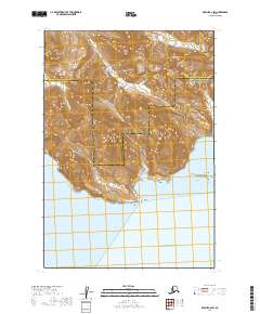
2019 Map of Karluk C-6 SW
USGS Topo · Published 2019About this map
Cape Kanatak anchors the shoreline of this coastal stretch along the Pacific Ocean, where the boundary between the Lake and Peninsula Borough and Kodiak Island Borough meets the sea. The landscape is defined by its dramatic marine inlets, including the sheltered waters of Portage Bay and the twin reaches of Jute Bay and Island Bay. Just offshore, the Jute Islands provide a buffer against the open ocean. Inland, the terrain is shaped by a network of drainage systems, most notably Salmon Cr, Bear Cr, and Kanatak Cr, which carve through the high elevations. This 2019 survey documents a sparsely populated but ecologically complex transition where the Kodiak archipelago meets the mainland peninsula, captured in the final years before the next decade of topographic updates.
Find a feature on this map
13 named features on this map. Tap any name to fly to it.
Don’t see what you’re looking for? This feature index may not catch every label — zoom into the map to look around manually.
Map Details
Editions of this 2019 Karluk C-6 SW Map
This is the sole edition of this map. No revisions or reprints were ever made.
Other maps of this area

1943 · Ugashik
USGS Topo · 1:250,000

1948 · Ugashik
USGS Topo · 1:250,000

1949 · Ugashik
USGS Topo · 1:250,000

1951 · Karluk
USGS Topo · 1:250,000

1951 · Ugashik B-1
USGS Topo · 1:63,360

1951 · Ugashik C-1
USGS Topo · 1:63,360
1951 · Karluk C-6
USGS Topo · 1:63,360

1952 · Karluk
USGS Topo · 1:250,000

1963 · Ugashik
USGS Topo · 1:250,000

1964 · Karluk
USGS Topo · 1:250,000