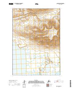
2019 Map of Karluk D-6 NW
USGS Topo · Published 2019About this map
Becharof Lake defines the southwestern expanse of this remote Alaskan landscape, where the water's edge meets a complex network of wetlands and small ponds. The terrain rises sharply to the northeast into the foothills of the Aleutian Range, creating a stark transition from the low-lying basin to higher elevations. This 2019 survey documents a wilderness largely defined by its natural hydrology, notably where Marie Cr drains toward the lake. The absence of roads or permanent settlements within this quadrangle emphasizes the primary role of the lake and its surrounding drainage systems in the local geography of the Alaska Peninsula. Researchers of this region will find the precise mapping of these water bodies and topographical contours essential for understanding the seasonal patterns and landform characteristics of the Lake and Peninsula Borough.
Find a feature on this map
9 named features on this map. Tap any name to fly to it.
Don’t see what you’re looking for? This feature index may not catch every label — zoom into the map to look around manually.
Map Details
Editions of this 2019 Karluk D-6 NW Map
This is the sole edition of this map. No revisions or reprints were ever made.
Other maps of this area

1943 · Ugashik
USGS Topo · 1:250,000

1948 · Mt Katmai
USGS Topo · 1:250,000

1948 · Ugashik
USGS Topo · 1:250,000

1949 · Ugashik
USGS Topo · 1:250,000

1951 · Mt Katmai
USGS Topo · 1:250,000

1951 · Karluk
USGS Topo · 1:250,000

1951 · Mount Katmai A-6
USGS Topo · 1:63,360

1951 · Ugashik D-1
USGS Topo · 1:63,360

1951 · Karluk D-6
USGS Topo · 1:63,360

1951 · Naknek A-1
USGS Topo · 1:63,360