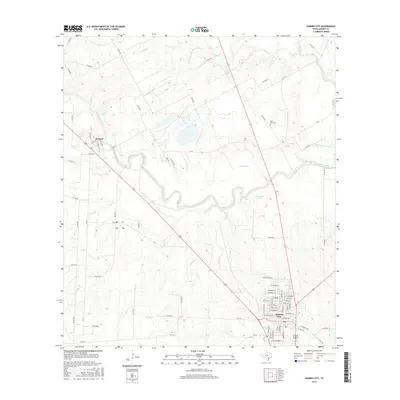
2016 Map of Karnes City
USGS Topo · Published 2016About this map
Karnes City serves as a focal point in this South Texas landscape, where the grid of city streets meets the winding hydrology of the San Antonio River basin. The river snakes across the central portion of the map, creating distinctive landforms such as Horseshoe Lake and feeding into Lake Slough. To the northwest, the small community of Hobson sits near the banks of the river, while the rural interior is defined by a dense network of drainage systems including Turkey Creek, Cibolo Creek, and Jacobs Creek. Local history is anchored by the Saint Mary Cemetery located north of the city. The map documents a blend of agricultural land and modern infrastructure, including numerous farm-to-market roads and county routes that connect the scattered homesites and ranch lands of Karnes County.
Find a feature on this map
80 named features on this map. Tap any name to fly to it.
Don’t see what you’re looking for? This feature index may not catch every label — zoom into the map to look around manually.
Map Details
Editions of this 2016 Karnes City Map
This is the sole edition of this map. No revisions or reprints were ever made.
Other maps of this area

1920 · Smiley
USGS Topo · 1:125,000

1925 · Tordia No. 1
USGS Topo · 1:48,000

1931 · Falls City
USGS Topo · 1:62,500

1936 · Floresville
USGS Topo · 1:62,500

1953 · Crystal City
USGS Topo · 1:250,000

1953 · Beeville
USGS Topo · 1:250,000

1953 · Seguin
USGS Topo · 1:250,000

1954 · San Antonio
USGS Topo · 1:250,000

1955 · Crystal City
USGS Topo · 1:250,000

1956 · Beeville
USGS Topo · 1:250,000