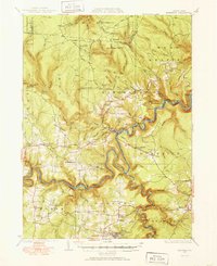
1929 Map of Karthaus
USGS Topo · Published 1952About this map
The West Branch Susquehanna River carves a deep, serpentine path through this 1929 survey, acting as a corridor for the New York Central Railroad and the Central Railroad of Pennsylvania. Industrial and community life is centered around the river and the coal-bearing ridges, highlighted by the Perry Moshannon Mine near Pottersdale and the Blackwell Dam on Mosquito Run. The rural landscape is densely populated with small educational and social centers, from the Apollo Rangers Club in the north to the Palestine Ch in the south.
Find a feature on this map
108 named features on this map. Tap any name to fly to it.
Don’t see what you’re looking for? This feature index may not catch every label — zoom into the map to look around manually.
Map Details
Editions of this 1929 Karthaus Map
3 editions found
Other maps of this area

1903 · Houtzdale
USGS Topo · 1:62,500

1905 · Houtzdale
USGS Topo · 1:62,500

1908 · Bellefonte
USGS Topo · 1:62,500

1909 · Bellefonte
USGS Topo · 1:62,500

1922 · Philipsburg
USGS Topo · 1:62,500

1928 · Snow Shoe
USGS Topo · 1:48,000

1929 · Karthaus
USGS Topo · 1:62,500

1929 · Clearfield
USGS Topo · 1:48,000

1931 · Show Shoe
USGS Topo · 1:62,500

1932 · Clearfield
USGS Topo · 1:62,500
Featured Places
- Karthaus Township, PA
- Moshannon, PA
- Benezette Township, PA
- Rush Township, PA
- Rolling Stone, Covington Township