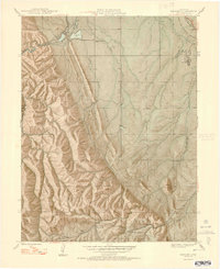
1948 Map of Kassler
USGS Topo · Published 1948About this map
Kassler and the northern reaches of the Hogback dominate this 1940s landscape, where water management and mountain terrain meet the edge of the plains. The South Platte River flows through the northwest, feeding a Filtration Pond and Reservoir critical to the Denver water system. The interplay between industrial infrastructure and the wilderness of the Pike National Forest is evident in the presence of the Indian Creek Ranger Sta and various rural educational hubs such as Jarre Canyon Sch and Roxborough Park Sch.
Find a feature on this map
27 named features on this map. Tap any name to fly to it.
Don’t see what you’re looking for? This feature index may not catch every label — zoom into the map to look around manually.
Map Details
Editions of this 1948 Kassler Map
2 editions found

Other maps of this area

1890 · East Denver
USGS Topo · 1:125,000

1893 · Platte Canyon
USGS Topo · 1:125,000

1894 · Castle Rock
USGS Topo · 1:125,000

1899 · West Denver
USGS Topo · 1:125,000

1913 · Castle Rock
USGS Topo · 1:125,000

1935 · East Denver Nos. 3 and 4
USGS Topo · 1:48,000

1940 · Castle Rock
USGS Topo · 1:62,500

1942 · Highland Ranch
USGS Topo · 1:31,680

1942 · Littleton
USGS Topo · 1:31,680

1945 · Castle Rock
USGS Topo · 1:62,500