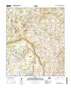
2016 Map of Kateel River A-2 SW
USGS Topo · Published 2016About this map
Uninhabited interior wilderness defines this region of the Kateel River A-2 SW quadrangle, where the Public Land Survey System grid provides the primary framework for navigation. The landscape is an intricate network of wetlands and small water bodies, typical of the Alaskan interior's drainage patterns. Mapping of this area relies heavily on remote sensing data, including SPOT imagery from 2009 to 2015 and National Elevation Dataset contours from 2016. The map delineates the boundaries of T4s R9e, T4s R10e, T5s R9e, and T5s R10e. This specific quadrant is focused on a terrain devoid of modern infrastructure or established settlements, showing instead a natural state largely untouched by development or road networks. The lack of named geographical landmarks beyond the township and range identifiers suggests a territory that remained largely unsurveyed for traditional habitation well into the early 21st century.
Find a feature on this map
6 named features on this map. Tap any name to fly to it.
Don’t see what you’re looking for? This feature index may not catch every label — zoom into the map to look around manually.
Map Details
Editions of this 2016 Kateel River A-2 SW Map
This is the sole edition of this map. No revisions or reprints were ever made.
Other maps of this area

1945 · Nulato
USGS Topo · 1:250,000

1951 · Nulato
USGS Topo · 1:250,000

1951 · Kateel River
USGS Topo · 1:250,000

1952 · Kateel River A-2
USGS Topo · 1:63,360

1952 · Nulato D-3
USGS Topo · 1:63,360

1952 · Nulato D-2
USGS Topo · 1:63,360

1952 · Kateel River A-3
USGS Topo · 1:63,360

1952 · Nulato
USGS Topo · 1:250,000
1954 · Nulato D-2
USGS Topo · 1:63,360
1954 · Nulato D-3
USGS Topo · 1:63,360