
1952 Map of Nulato
USGS Topo · Published 1958About this map
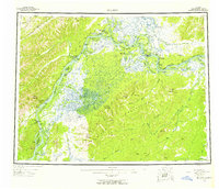
The Yukon River carves a massive corridor through the Alaska interior in the mid-1950s, serving as the primary artery for travel between Nulato, Galena, and Kaltag. This survey shows the region's transition from traditional river-based life to the strategic aviation era, most notably at the Galena Air Force Base which stands as a prominent cold-war fixture along the riverbank. Nearby, civil aviation infrastructure like the CAA Station and several Radio Towers punctuate the landscape of sloughs and islands.
Find a feature on this map
58 named features on this map. Tap any name to fly to it.
Don’t see what you’re looking for? This feature index may not catch every label — zoom into the map to look around manually.
Map Details
Editions of this 1952 Nulato Map
4 editions found
Other maps of this area

1945 · Nulato
USGS Topo · 1:250,000

1948 · Norton Bay
USGS Topo · 1:250,000

1950 · Medfra
USGS Topo · 1:250,000

1951 · Candle
USGS Topo · 1:250,000

1951 · Ophir
USGS Topo · 1:250,000

1951 · Nulato
USGS Topo · 1:250,000

1951 · Unalakleet
USGS Topo · 1:250,000

1951 · Ruby
USGS Topo · 1:250,000

1951 · Norton Bay
USGS Topo · 1:250,000

1951 · Kateel River
USGS Topo · 1:250,000