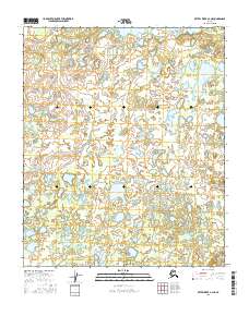
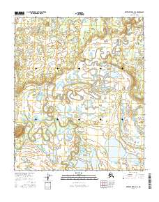
2016 Map of Kateel River A-3 NE
USGS Topo · Published 2016About this map
Louis Lake sits as the primary named hydrological feature in this remote section of the Yukon-Koyukuk region. The landscape is defined by an intricate network of wetlands and small, unnamed water bodies that cover nearly every section of the grid. Surveyed by the U.S. Geological Survey, the area is divided into several townships, including t3s r8e, t3s r9e, t4s r8e, and t4s r9e. The terrain represents a complex aquatic environment where the boundaries between land and water are constantly shifting, typical of the interior Alaskan wilderness. This specific quadrant, captured in the mid-2010s, offers a detailed look at the hydrography of the Kateel River basin before further natural or geological shifts occur.
Find a feature on this map
5 named features on this map. Tap any name to fly to it.
Don’t see what you’re looking for? This feature index may not catch every label — zoom into the map to look around manually.
Map Details
Editions of this 2016 Kateel River A-3 NE Map
This is the sole edition of this map. No revisions or reprints were ever made.
Other maps of this area

1951 · Kateel River
USGS Topo · 1:250,000

1952 · Kateel River A-2
USGS Topo · 1:63,360

1952 · Kateel River A-3
USGS Topo · 1:63,360

1952 · Kateel River B-3
USGS Topo · 1:63,360

1952 · Kateel River B-2
USGS Topo · 1:63,360

1955 · Kateel River
USGS Topo · 1:250,000
2015 · Kateel River B-3 SW
USGS Topo · 1:25,000
2015 · Kateel River A-3 NW
USGS Topo · 1:25,000
2015 · Kateel River A-3 SW
USGS Topo · 1:25,000
2016 · Kateel River A-3 SE
USGS Topo · 1:25,000