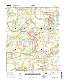
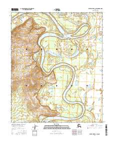
2016 Map of Kateel River C-1 NW
USGS Topo · Published 2016About this map
Huslia serves as the focal point of this Alaskan landscape, situated along a sharp bend of the Koyukuk River. The settlement is defined by its vital transportation links, including the Huslia Airport and a small network of local routes such as Airport Road and Lona Lake Road. The surrounding geography is a complex system of active and ancient watercourses, characterized by the winding paths of Racetrack Slough and Richards Slough. These seasonal and permanent waterways, along with features like Long Lake and Mingogut Lake, illustrate the dynamic nature of the river valley. The map documents the layout of this remote interior community, highlighting how infrastructure like the Landfill Access road and Spring Camp Road extends from the village center into the wilderness.
Find a feature on this map
17 named features on this map. Tap any name to fly to it.
Don’t see what you’re looking for? This feature index may not catch every label — zoom into the map to look around manually.
Map Details
Editions of this 2016 Kateel River C-1 NW Map
This is the sole edition of this map. No revisions or reprints were ever made.
Other maps of this area

1951 · Kateel River
USGS Topo · 1:250,000

1954 · Kateel River C-2
USGS Topo · 1:63,360

1954 · Kateel River C-1
USGS Topo · 1:63,360

1954 · Kateel River D-1
USGS Topo · 1:63,360

1955 · Kateel River D-2
USGS Topo · 1:63,360

1955 · Kateel River
USGS Topo · 1:250,000
2016 · Kateel River C-2 SE
USGS Topo · 1:25,000
2016 · Kateel River D-2 SE
USGS Topo · 1:25,000
2016 · Kateel River C-1 SE
USGS Topo · 1:25,000
2016 · Kateel River C-1 SW
USGS Topo · 1:25,000