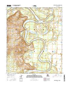
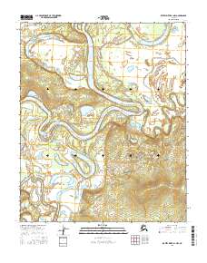
2016 Map of Kateel River C-1 SW
USGS Topo · Published 2016About this map
The Koyukuk River dominates this interior landscape, winding in broad, rhythmic meanders across the floodplain. The river's path is characterized by numerous oxbows and abandoned channels, illustrating a dynamic fluvial system in a region largely defined by its watercourses. Flanking the main channel are seasonal water bodies including Fish Lake and Long Lake, which serve as vital landmarks in an area otherwise marked by undulating contours and surveyed township boundaries such as t3n r12e and t2n r12e. This 2016 survey by the U.S. Geological Survey documents the wilderness character of the Yukon-Koyukuk region, where the lack of roads and settlements emphasizes the reliance on the river as the primary corridor for movement and geography.
Find a feature on this map
12 named features on this map. Tap any name to fly to it.
Don’t see what you’re looking for? This feature index may not catch every label — zoom into the map to look around manually.
Map Details
Editions of this 2016 Kateel River C-1 SW Map
This is the sole edition of this map. No revisions or reprints were ever made.
Other maps of this area

1951 · Kateel River
USGS Topo · 1:250,000

1952 · Kateel River B-1
USGS Topo · 1:63,360

1952 · Kateel River B-2
USGS Topo · 1:63,360

1954 · Kateel River C-2
USGS Topo · 1:63,360

1954 · Kateel River C-1
USGS Topo · 1:63,360

1955 · Kateel River
USGS Topo · 1:250,000
2016 · Kateel River C-2 SE
USGS Topo · 1:25,000
2016 · Kateel River B-2 NE
USGS Topo · 1:25,000
2016 · Kateel River C-1 SE
USGS Topo · 1:25,000
2016 · Kateel River B-1 NW
USGS Topo · 1:25,000