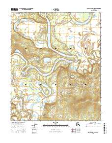
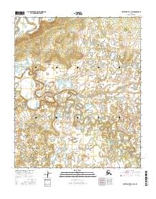
2016 Map of Kateel River B-1 NW
USGS Topo · Published 2016About this map
The Koyukuk River dominates this interior Alaska landscape, carving a serpentine path through the low-lying river valley. The intricate hydrology of the region is further defined by the Dulbi Slough and the Dulbi River, creating a network of oxbow lakes and side channels typical of this subarctic environment. A lone named landmark, Dubin Point, rises slightly above the surrounding wetlands on the northern bank of a wide river bend. This 2016 survey by the U.S. Geological Survey illustrates the dynamic nature of these waterways, where seasonal shifts continually reshape the gravel bars and embankments across several township boundaries including t1n r12e and t1s r12e.
Find a feature on this map
9 named features on this map. Tap any name to fly to it.
Don’t see what you’re looking for? This feature index may not catch every label — zoom into the map to look around manually.
Map Details
Editions of this 2016 Kateel River B-1 NW Map
This is the sole edition of this map. No revisions or reprints were ever made.
Other maps of this area

1951 · Kateel River
USGS Topo · 1:250,000

1952 · Kateel River B-1
USGS Topo · 1:63,360

1952 · Kateel River B-2
USGS Topo · 1:63,360

1954 · Kateel River C-2
USGS Topo · 1:63,360

1954 · Kateel River C-1
USGS Topo · 1:63,360

1955 · Kateel River
USGS Topo · 1:250,000
2016 · Kateel River C-2 SE
USGS Topo · 1:25,000
2016 · Kateel River B-2 NE
USGS Topo · 1:25,000
2016 · Kateel River C-1 SE
USGS Topo · 1:25,000
2016 · Kateel River B-1 SW
USGS Topo · 1:25,000