
1952 Map of Kateel River B-1
USGS Topo · Published 1958About this map
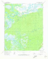
The Koyukuk River dominates this interior Alaska landscape, captured through aerial photography in the early 1950s. The river's winding path is marked by sharp oxbows and a series of cabins located along its banks, suggesting seasonal habitation or remote outposts for hunting and trapping. Tributaries like the Dulbi River and the Holtnikatna River feed into the broader valley, creating a complex network of wetlands and a prominent Slough in the northern reaches. The terrain rises to distinct landmarks such as Dubin Pt, providing topographic contrast to the low-lying river basin. This survey provides a precise look at the hydrology and rudimentary settlement patterns in the Yukon-Koyukuk region before significant modern development, documenting a wilderness shaped entirely by its waterways.
Find a feature on this map
6 named features on this map. Tap any name to fly to it.
Don’t see what you’re looking for? This feature index may not catch every label — zoom into the map to look around manually.
Map Details
Editions of this 1952 Kateel River B-1 Map
2 editions found
Other maps of this area

1951 · Kateel River
USGS Topo · 1:250,000

1951 · Melozitna
USGS Topo · 1:250,000

1952 · Kateel River A-2
USGS Topo · 1:63,360

1952 · Kateel River A-1
USGS Topo · 1:63,360

1952 · Kateel River B-2
USGS Topo · 1:63,360
1952 · Melozitna A-6
USGS Topo · 1:63,360

1954 · Kateel River C-2
USGS Topo · 1:63,360

1954 · Melozitna C-6
USGS Topo · 1:63,360

1954 · Kateel River C-1
USGS Topo · 1:63,360
1954 · Melozitna B-6
USGS Topo · 1:63,360