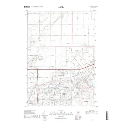
2018 Map of Kaukauna
USGS Topo · Published 2018About this map
The Fox River carves through the heart of this Wisconsin landscape, defining the industrial and civic development of Little Chute, Kimberly, and Kaukauna. This survey details the river's complex engineering at Combined Locks and around the Little Chute Islands, where the waterway's power historically fueled the region's milling and manufacturing growth. To the north, the transition from urban density to rural reaches is marked by the eponymous Apple Creek and several long-established cemeteries including Saint John Cem and Saint Mary's Cem, which serve as vital touchstones for local genealogical research. The transportation network is anchored by the Canadian National rail lines and a dense grid of county roads that bridge the gap between the eastern edge of Appleton and the surrounding agricultural tracts in Outagamie County.
Find a feature on this map
250 named features on this map. Tap any name to fly to it.
Don’t see what you’re looking for? This feature index may not catch every label — zoom into the map to look around manually.
Map Details
Editions of this 2018 Kaukauna Map
This is the sole edition of this map. No revisions or reprints were ever made.
Other maps of this area

1911 · Neenah
USGS Topo · 1:62,500

1954 · De Pere
USGS Topo · 1:62,500

1954 · Chilton
USGS Topo · 1:62,500

1955 · Neenah
USGS Topo · 1:62,500

1955 · Appleton
USGS Topo · 1:24,000

1955 · Appleton
USGS Topo · 1:62,500

1955 · Neenah
USGS Topo · 1:24,000

1955 · Green Bay
USGS Topo · 1:250,000

1974 · Hilbert
USGS Topo · 1:24,000

1974 · Kaukauna
USGS Topo · 1:24,000