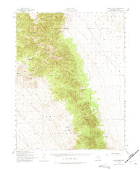
1952 Map of Kawich Peak
USGS Topo · Published 1975About this map
Kawich Peak stands as the high point of this high-desert landscape in Nye County, where the massive Kawich Range transitions into the expansive Reveille Valley to the east. In the early 1950s, the southern portion of this territory was dominated by the Las Vegas Bombing and Gunnery Range, a major military installation that restricted civilian access across a wide swathe of the terrain south of the Mt Diablo Base Line. Despite this military presence, localized ranching and prospecting endured at the mountain fringes.
Find a feature on this map
17 named features on this map. Tap any name to fly to it.
Don’t see what you’re looking for? This feature index may not catch every label — zoom into the map to look around manually.
Map Details
Editions of this 1952 Kawich Peak Map
3 editions found
Other maps of this area

1908 · Kawich
USGS Topo · 1:250,000

1942 · Cactus Range
USGS Topo · 1:125,000

1942 · Reveille Peak
USGS Topo · 1:125,000

1952 · Stinking Spring
USGS Topo · 1:62,500

1952 · Mellan
USGS Topo · 1:62,500

1952 · Kawich Peak
USGS Topo · 1:62,500

1952 · Quartzite Mtn
USGS Topo · 1:62,500

1952 · Reveille Peak
USGS Topo · 1:62,500

1952 · Belted Peak
USGS Topo · 1:62,500

1954 · Goldfield
USGS Topo · 1:250,000