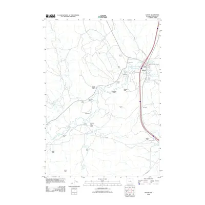
2012 Map of Kaycee
USGS Topo · Published 2012About this map
The Middle Fork Powder River carves through this central Wyoming landscape, serving as the primary hydrological anchor for the ranching operations that define the region. In the early 21st century, the town of Kaycee stands as the central hub, surrounded by a network of established homesteads including the Gosney Ranch, Fauber Ranch, and Fisher Ranch. The map reveals a complex system of water management essential for high-plains agriculture, evidenced by irrigation features like the Murphy Ditch, Vruwink Ditch, and Keith Ditch. To the west, the terrain rises toward Pine Ridge, while the southern reaches are marked by the prominent geological formation of Castle Rock. Transportation is dominated by the modern interstate corridor, yet older routes like Old Barnum Rd and Lone Bear Rd continue to trace the historical movements of people and livestock through the draws and flats.
Find a feature on this map
48 named features on this map. Tap any name to fly to it.
Don’t see what you’re looking for? This feature index may not catch every label — zoom into the map to look around manually.
Map Details
Editions of this 2012 Kaycee Map
This is the sole edition of this map. No revisions or reprints were ever made.
Other maps of this area

1955 · Arminto
USGS Topo · 1:250,000

1958 · Arminto
USGS Topo · 1:250,000

1961 · Barnum
USGS Topo · 1:62,500

1961 · Kaycee NE
USGS Topo · 1:24,000

1961 · Dry Creek Reservoir
USGS Topo · 1:24,000

1961 · TTT Ranch
USGS Topo · 1:24,000

1961 · Wall Creek
USGS Topo · 1:24,000

1961 · Hibbard Draw
USGS Topo · 1:24,000

1961 · Kaycee
USGS Topo · 1:24,000

1962 · Arminto
USGS Topo · 1:250,000