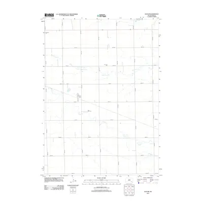
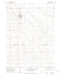
2012 Map of Kaylor
USGS Topo · Published 2012About this map
Dawson Cr and its tributaries carve a meandering path across this part of Hutchinson County, defining the drainage patterns of a landscape deeply rooted in the grid-based settlement of the Great Plains. The small community layout is centered on the junction of N Main St and S Main St, intersected by 1st St and 2nd St. This rural township reflects its pioneer heritage through preserved burial grounds such as Saint Johns Cem, Siamental Cem, and Dennewitz Cem, which are scattered among the section lines. The northern portion of the map is defined by the valley of Lonetree Cr and the S Br Lonetree Cr, while US Highway 18 provides the primary east-west transport corridor through the northern sections.
Find a feature on this map
26 named features on this map. Tap any name to fly to it.
Don’t see what you’re looking for? This feature index may not catch every label — zoom into the map to look around manually.
Map Details
Editions of this 2012 Kaylor Map
This is the sole edition of this map. No revisions or reprints were ever made.
Other maps of this area

1898 · Olivet
USGS Topo · 1:125,000

1955 · Sioux Falls
USGS Topo · 1:250,000

1957 · Tschetter Colony
USGS Topo · 1:24,000

1957 · Scotland
USGS Topo · 1:24,000

1958 · Sioux Falls
USGS Topo · 1:250,000

1978 · Tripp SE
USGS Topo · 1:24,000
1978 · Kloucek Lake
USGS Topo · 1:24,000
1978 · Haucks Lake
USGS Topo · 1:24,000
1978 · Kaylor
USGS Topo · 1:24,000
1978 · Tripp
USGS Topo · 1:24,000