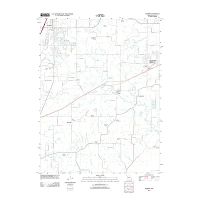
2012 Map of Kearney
USGS Topo · Published 2012About this map
Jesse James Farm Rd cuts through the rural landscape of Clay County, reflecting the deep local ties to the regional heritage of this Missouri corridor. The area is defined by the winding course of the Fishing River and its numerous tributaries, including Clear Creek and Crockett Creek, which carve through the undulating terrain between the growing settlements of Kearney and Excelsior Springs. This map reveals a high density of family and community burial grounds, such as Munkirs Cemetery, Baldwin Cemetery, and Old Liberty Cemetery, which serve as vital markers for genealogical research. The transition from agricultural use to modern infrastructure is evident in the presence of the Royal Wood Aerodrome Airport and the development around Mosby, where the Mosby Post Office stands near the confluence of local streams.
Find a feature on this map
102 named features on this map. Tap any name to fly to it.
Don’t see what you’re looking for? This feature index may not catch every label — zoom into the map to look around manually.
Map Details
Editions of this 2012 Kearney Map
This is the sole edition of this map. No revisions or reprints were ever made.
Other maps of this area

1894 · Independence
USGS Topo · 1:125,000

1935 · Buckner
USGS Topo · 1:24,000

1935 · Missouri City
USGS Topo · 1:24,000

1935 · Liberty
USGS Topo · 1:24,000

1936 · Kearney
USGS Topo · 1:48,000

1940 · Liberty
USGS Topo · 1:31,680

1942 · Kearney
USGS Topo · 1:62,500

1945 · Kearney
USGS Topo · 1:62,500
1945 · Missouri City
USGS Topo · 1:24,000
1947 · Missouri City
USGS Topo · 1:31,680