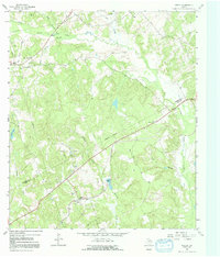
1964 Map of Keechi
USGS Topo · Published 1992About this map
The Oakwood Dome Oil Field defines much of the industrial character of this landscape along the Freestone Co Leon Co boundary during the early 1960s. This survey illustrates a rural texture of small family cemeteries and country institutions, including the Plum Creek Cem and Trahan Sch nestled between the various forks of Upper Keechi Creek. The settlement of Keechi serves as a small anchor in a region otherwise dominated by winding waterways like Alligator Creek and Mustang Creek. Scattered drill holes and a gravel pit point to the localized resource extraction that occurred alongside agricultural life, while landmarks like the Roadside Park and a Gaging Sta mark the human attempts to manage and navigate this low-lying, creek-cut terrain.
Find a feature on this map
26 named features on this map. Tap any name to fly to it.
Don’t see what you’re looking for? This feature index may not catch every label — zoom into the map to look around manually.
Map Details
Editions of this 1964 Keechi Map
2 editions found
Other maps of this area

1919 · Fairfield
USGS Topo · 1:62,500

1953 · Palestine
USGS Topo · 1:250,000

1954 · Waco
USGS Topo · 1:250,000

1955 · Waco
USGS Topo · 1:250,000

1956 · Jewett
USGS Topo · 1:62,500

1957 · Palestine
USGS Topo · 1:250,000

1964 · Long Lake
USGS Topo · 1:24,000

1964 · Oakwood
USGS Topo · 1:24,000

1964 · Flo
USGS Topo · 1:24,000

1964 · Keechi
USGS Topo · 1:24,000