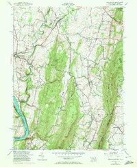
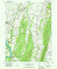
1953 Map of Keedysville
USGS Topo · Published 1972About this map
Antietam National Battlefield and the surrounding Maryland countryside are meticulously documented in this mid-century topographic record, which incorporates revisions through the early 1970s. The landscape is defined by the sharp ridges of Elk Ridge and South Mountain, framing the fertile valleys where Antietam Creek meanders toward the Potomac River. The map preserves the locations of vital Civil War landmarks, including Antietam National Cemetery, Burnside Bridge, and the Hawkins Monument.
Find a feature on this map
61 named features on this map. Tap any name to fly to it.
Don’t see what you’re looking for? This feature index may not catch every label — zoom into the map to look around manually.
Map Details
Editions of this 1953 Keedysville Map
5 editions found
Other maps of this area

1884 · Harpers Ferry
USGS Topo · 1:125,000

1891 · Harpers Ferry
USGS Topo · 1:125,000

1893 · Harpers Ferry
USGS Topo · 1:125,000

1908 · Middletown
USGS Topo · 1:48,000

1909 · Hagerstown
USGS Topo · 1:48,000

1910 · Antietam
USGS Topo · 1:62,500

1912 · Hagerstown
USGS Topo · 1:62,500

1912 · Williamsport
USGS Topo · 1:62,500

1914 · Martinsburg
USGS Topo · 1:48,000

1916 · Martinsburg
USGS Topo · 1:62,500