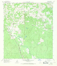
1962 Map of Keenan
USGS Topo · Published 1971About this map
Family cemeteries and small church congregations anchor this 1962 landscape in Montgomery County, reflecting the deep-rooted settlement patterns of the Texas Piney Woods. Significant local history sites such as Keenan Cem, Rabon Cartwright Cem, and the St Beulah Ch are scattered across the terrain, often located near the winding course of Lake Creek. The area is defined by its rail-reliant economy, with the Gulf Colorado and Santa Fe and the Chicago Rock Island and Pacific railroads providing vital connections for timber and agricultural goods.
Find a feature on this map
31 named features on this map. Tap any name to fly to it.
Don’t see what you’re looking for? This feature index may not catch every label — zoom into the map to look around manually.
Map Details
Editions of this 1962 Keenan Map
Other maps of this area

1954 · Beaumont
USGS Topo · 1:250,000

1957 · Beaumont
USGS Topo · 1:250,000

1958 · Cowl Spur
USGS Topo · 1:24,000

1958 · Lake Paula
USGS Topo · 1:24,000

1959 · Montgomery
USGS Topo · 1:24,000

1962 · Keenan
USGS Topo · 1:24,000
1962 · Oklahoma
USGS Topo · 1:24,000

1962 · Dacus
USGS Topo · 1:24,000

1962 · Plantersville
USGS Topo · 1:24,000
1962 · Magnolia East
USGS Topo · 1:24,000