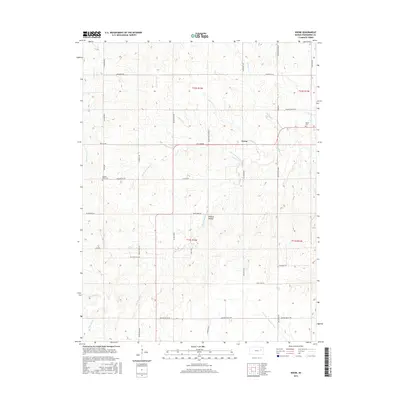
2015 Map of Keene
USGS Topo · Published 2015About this map
Keene serves as the central hub for this rural stretch of Wabaunsee County, where the landscape is defined by the headwaters and branches of several prominent regional waterways. The drainage patterns of Snokomo Creek, Mission Creek, and the South Branch Wakarusa River create a complex topography of ridges and draws, most notably at Wildcat Hollow. This 2015 survey reveals a persistent agricultural grid, where modern roads like Skyline Road and Mission Valley Road follow township lines established generations earlier. Genealogists can identify significant local landmarks such as Keene Cemetery and Mission View Cemetery, while the presence of Military Trail Road alludes to the historical corridor that once facilitated movement across the Kansas prairie. The map illustrates how contemporary land use remains deeply tied to these natural drainages, with naming conventions like North Branch Mission Creek and South Branch Mission Creek reflecting the importance of these forks to the local geography.
Find a feature on this map
48 named features on this map. Tap any name to fly to it.
Don’t see what you’re looking for? This feature index may not catch every label — zoom into the map to look around manually.
Map Details
Editions of this 2015 Keene Map
This is the sole edition of this map. No revisions or reprints were ever made.
Other maps of this area

1885 · Eskridge
USGS Topo · 1:125,000

1889 · Burlingame
USGS Topo · 1:125,000

1889 · Wamego
USGS Topo · 1:125,000

1889 · Eskridge
USGS Topo · 1:125,000

1889 · Topeka
USGS Topo · 1:125,000

1894 · Eskridge
USGS Topo · 1:125,000

1894 · Burlingame
USGS Topo · 1:125,000

1894 · Topeka
USGS Topo · 1:125,000

1894 · Wamego
USGS Topo · 1:125,000

1947 · Lawrence
USGS Topo · 1:250,000