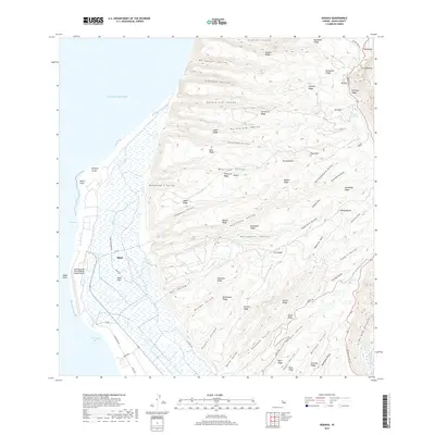
2017 Map of Kekaha
USGS Topo · Published 2017About this map
The settlement of Mānā sits at the edge of the coastal plains, serving as a focal point for this western Kauai landscape where agricultural water management meets military infrastructure. Irrigation is a defining characteristic of the lowland, with the Mānā Reservoir and Mānā Plain indicating a history of intensive land use. The Barking Sands Pacific Missile Range Facility occupies a significant portion of the coastline near Waiokapua Bay, marking the modern strategic role of the area.
Find a feature on this map
82 named features on this map. Tap any name to fly to it.
Don’t see what you’re looking for? This feature index may not catch every label — zoom into the map to look around manually.
Map Details
Editions of this 2017 Kekaha Map
This is the sole edition of this map. No revisions or reprints were ever made.
Other maps of this area

1954 · Kauai
USGS Topo · 1:250,000

1963 · Kekaha
USGS Topo · 1:24,000

1963 · Hanapepe
USGS Topo · 1:24,000

1965 · Waimea Canyon
USGS Topo · 1:24,000

1965 · Haena
USGS Topo · 1:24,000

1965 · Makaha Point
USGS Topo · 1:24,000

1967 · Kauai
USGS Topo · 1:250,000

1970 · Kauai
USGS Topo · 1:250,000
1977 · Hanapepe
USGS Topo · 1:24,000
1983 · Haena
USGS Topo · 1:24,000