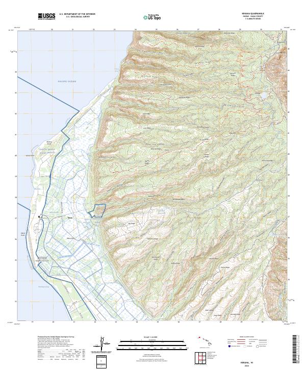
2024 Map of Kekaha
USGS Topo · Published 2024About this map
The Mana Plain dominates this western Kauai landscape, where the agricultural legacy of Mānā meets modern defense infrastructure. On the low-lying coastal flats, the Mana Japanese Cem stands as a significant genealogical marker of the Japanese immigrant community that worked the local plantations. This transition from historical settlement to modern utility is evidenced by the proximity of the Mana Swamp and Mānā Reservoir to the sprawling Pacific Missile Range Facility and its associated Barking Sands Pacific Missile Range Facility Airport.
Find a feature on this map
92 named features on this map. Tap any name to fly to it.
Don’t see what you’re looking for? This feature index may not catch every label — zoom into the map to look around manually.
Map Details
Editions of this 2024 Kekaha Map
This is the sole edition of this map. No revisions or reprints were ever made.
Other maps of this area

1954 · Kauai
USGS Topo · 1:250,000

1963 · Kekaha
USGS Topo · 1:24,000

1963 · Hanapepe
USGS Topo · 1:24,000

1965 · Waimea Canyon
USGS Topo · 1:24,000

1965 · Haena
USGS Topo · 1:24,000

1965 · Makaha Point
USGS Topo · 1:24,000

1967 · Kauai
USGS Topo · 1:250,000

1970 · Kauai
USGS Topo · 1:250,000
1977 · Hanapepe
USGS Topo · 1:24,000
1983 · Haena
USGS Topo · 1:24,000