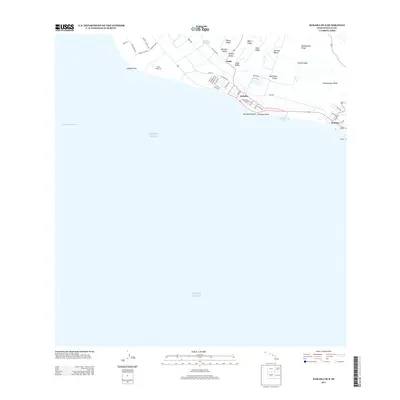
2013 Map of Kekaha OE S
USGS Topo · Published 2013About this map
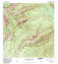
The coastal settlements of Kekaha and Waimea anchor this 2013 survey of Kauai’s southwestern shore, where the island's interior ridges descend toward the Pacific Ocean. The map documents a transition from the agricultural and industrial infrastructure of the lowlands to the dramatic topography of the volcanic uplands. Notable features include the Waiawa Reservoir and the Mana Drag Strip near Kokole Point, illustrating how the flat coastal plains have been utilized for both water management and modern recreation. To the east, the shoreline is punctuated by Kikiaola Harbor and 'Ō'ōmanō Point, while the northern portion of the quadrangle is defined by a series of prominent finger ridges and deep erosional cuts, such as Puehu Ridge, Paua Valley, and Kaleinamanu Ridge. This terrain layout demonstrates the classic Hawaiian geomorphology where narrow valleys separate high, navigable ridges.
Find a feature on this map
49 named features on this map. Tap any name to fly to it.
Don’t see what you’re looking for? This feature index may not catch every label — zoom into the map to look around manually.
Map Details
Editions of this 2013 Kekaha OE S Map
This is the sole edition of this map. No revisions or reprints were ever made.
Other maps of this area

1954 · Kauai
USGS Topo · 1:250,000

1963 · Kekaha
USGS Topo · 1:24,000

1963 · Hanapepe
USGS Topo · 1:24,000

1965 · Waimea Canyon
USGS Topo · 1:24,000

1967 · Kauai
USGS Topo · 1:250,000

1970 · Kauai
USGS Topo · 1:250,000
1977 · Hanapepe
USGS Topo · 1:24,000
1983 · Hanapepe
USGS Topo · 1:24,000
1983 · Kekaha
USGS Topo · 1:24,000
1983 · Waimea Canyon
USGS Topo · 1:24,000