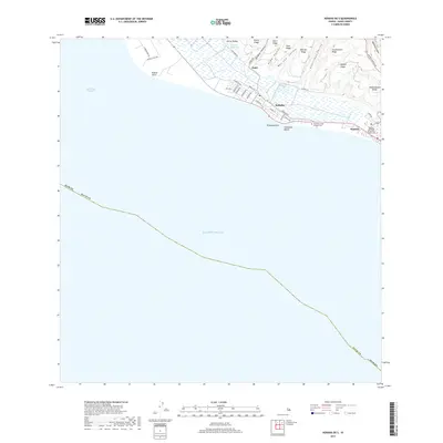
2017 Map of Kekaha OE S
USGS Topo · Published 2017About this map
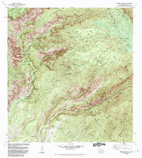
The coastal settlements of Kekaha and Waimea occupy the narrow lowland strip between the high ridges of Kauai and the Pacific Ocean. This 2017 survey shows a landscape defined by sharp topographical contrasts, where steep landforms like Puehu Ridge and Huluhulunui Ridge drop toward the shore. Cultural landmarks are clustered near the coast, including the Waimea United Church of Christ and the Park Hook Tong Chinese Cem, reflecting the area's social history. To the west, the Waiawa Reservoir sits in the Hō‘ea Valley, while the westernmost reaches of the legendary Waimea Canyon begin to carve into the eastern edge of the sheet. The transition from the Kaulakahi Channel to the shoreline at Davidsons Beach illustrates the proximity of these island communities to the sea.
Find a feature on this map
46 named features on this map. Tap any name to fly to it.
Don’t see what you’re looking for? This feature index may not catch every label — zoom into the map to look around manually.
Map Details
Editions of this 2017 Kekaha OE S Map
This is the sole edition of this map. No revisions or reprints were ever made.
Other maps of this area

1954 · Kauai
USGS Topo · 1:250,000

1963 · Kekaha
USGS Topo · 1:24,000

1963 · Hanapepe
USGS Topo · 1:24,000

1965 · Waimea Canyon
USGS Topo · 1:24,000

1967 · Kauai
USGS Topo · 1:250,000

1970 · Kauai
USGS Topo · 1:250,000
1977 · Hanapepe
USGS Topo · 1:24,000
1983 · Hanapepe
USGS Topo · 1:24,000
1983 · Kekaha
USGS Topo · 1:24,000
1983 · Waimea Canyon
USGS Topo · 1:24,000