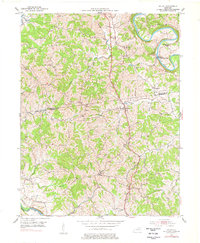
1953 Map of Kelat
USGS Topo · Published 1977About this map
The Licking River carves a dramatic, winding path through this portion of Pendleton and Harrison Counties, defining a landscape of deep valleys and high ridges. The rural character of the region is punctuated by numerous small country churches, such as Blanket Creek Ch, Antioch Ch, and both the Mt Vernon Ch and Old Mt Vernon Ch, which suggest long-standing community centers tied to specific family settlements and local watersheds.
Find a feature on this map
28 named features on this map. Tap any name to fly to it.
Don’t see what you’re looking for? This feature index may not catch every label — zoom into the map to look around manually.
Map Details
Editions of this 1953 Kelat Map
3 editions found
Other maps of this area

1929 · Cynthiana
USGS Topo · 1:48,000

1930 · Falmouth
USGS Topo · 1:48,000

1934 · Cynthiana
USGS Topo · 1:62,500

1936 · Falmouth
USGS Topo · 1:62,500

1952 · Berlin
USGS Topo · 1:24,000

1952 · Shady Nook
USGS Topo · 1:24,000

1952 · Claysville
USGS Topo · 1:24,000

1953 · Berry
USGS Topo · 1:24,000

1953 · Breckinridge
USGS Topo · 1:24,000

1953 · Kelat
USGS Topo · 1:24,000